Top 10 Largest States of India
List of Top 10 Largest States
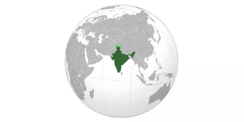
Today we are going to talk about the Top 10 Largest State of India. Our country consists of 28 states and 8 union territories. The capital of India is New Delhi. India has a total population of 1.2 billion people and that number is expected to grow in the coming years. The landscape of our country is vast and diverse. Every state in India has something unique within the country. So let us gather some more information about the Top 10 Largest state of India.
1. Rajasthan
Rajasthan is known as the largest land state in India. This state accounts for more than 10.4% of the total land area of India. Rajasthan is located near Pakistan in the western part of India and this state hosts the Great Indian Desert which is one of the largest tropical deserts in the world. The state of Rajasthan is most famous for its cultural and natural beauty.
Ancient and modern cultural heritage is found in this state. The name of the state of Rajasthan has been vindicated with magnificent forts and majestic palaces which are a fitting reminder of a rich, romantic past and which speak of heroism, honor and valor. The state of Rajasthan has a slightly higher tourist attraction. This state ranks seventh in terms of population.
Area : 342,239 km²
Population : 68,548,437 (2011 census)
Capital : Jaipur
Establishment : 30 March 1949
Districts : 33
2. Madhya Pradesh
This state is located in Madhya Pradesh, India and that is why Madhya Pradesh is called the Heartland State. Madhya Pradesh has the largest reserves of diamonds and copper in India as this state is rich in mineral resources. Madhya Pradesh experiences sub-tropical climate. This state is known as the second largest state in India in terms of land area.
The official language of Madhya Pradesh is Hindi. Madhya Pradesh is bordered by Gujarat to the west, Rajasthan to the west, Uttar Pradesh to the northeast, Chhattisgarh to the east and Maharashtra to the south. The area covered by the present state includes the area of the ancient Avanti Mahajanapada. Madhya Pradesh was divided into several princely states under the British and included Madhya Pradesh and Berar and Central India Agency.
Area : 308,252 km²
Population : 72,626,809 (2011 census)
Capital : Bhopal
Establishment : 1 November 1956
Districts : 52
3. Maharashtra
Maharashtra is the third largest state in India in terms of land area. Maharashtra is also the second largest state in the country in terms of population. This state is the seat of the Bollywood film industry. Maharashtra is also famous for sites like the Gateway of India monument of the British Raj era and the cave temples on nearby Elephanta Island. More tourists come to visit this state.
This state is found in west-central India and has a coastline on the Indian Ocean. Maharashtra is known for many things including monsoons, cave exploration, beaches and of course, a rich history of art and culture. The name of this state is derived from the words Maharashtri, Marathi and Maratha. This state occupies a significant part of the Deccan Plateau.
Area : 307,713 km²
Population : 112,374,333 (2011 census)
Capital : Mumbai
Establishment : 1 May 1960
Districts : 36
4. Uttar Pradesh
The state of Uttar Pradesh is the third largest state in India by land area. Uttar Pradesh is known as the most populous state in our country and Uttar Pradesh is the most populous sub-division of any country in the world. This state is very famous for being the home of the Taj Mahal. This state is one of the most important state economies in India and Uttar Pradesh is responsible for half of the sugarcane production in India.
This state is bounded on the east by Bihar. Uttar Pradesh touches the northern borders of Madhya Pradesh in the south, Rajasthan, Delhi, Himachal Pradesh and Haryana in the west and Uttaranchal and Nepal in the north. Uttar Pradesh is of strategic importance to Indian defense. The state is the largest producer of food grains in India and accounts for about 17.83% of the total food grain production in India.
Area : 240,928 km²
Population : 199,812,341 (2011 census)
Capital : Lucknow
Establishment : 24 January 1950
Districts : 75
5. Gujarat
This state is the fifth largest state in India in terms of land area. Gujarat is found in the northwest of India. This state has the longest coastline of any state in India. The entire coast of the state of Gujarat is on the Indian Ocean. As the ancestral home of Gujaratis, the state of Gujarat has a rich history. Gujarat is especially known for its arts and crafts traditions.
The state of Gujarat is locally known as the gem of the western part of India. The state of Gujarat is bordered by Rajasthan in the north, Maharashtra in the south, Madhya Pradesh and the Arabian Sea in the east, and Sindh in the west. Gujarat is best known for its Asian lions. In this state a large number of tourists come to see the lions. The state of Gujarat is widely regarded as the most industrially developed state and manufacturing hub of India.
Area : 196,024 km²
Population : 60,439,692 (2011 census)
Capital : Gandhinagar
Establishment : 1 May 1960
Districts : 33
6. Karnataka
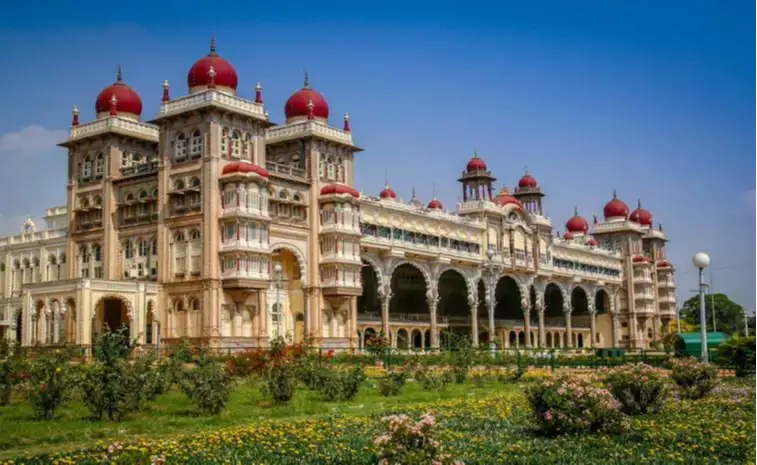
The state of Karnataka is the sixth largest state in India in terms of land area. This state is found in the south-west of India. Tourism is important for this state. One of the most famous attractions within the state of Karnataka is the Mysore Palace which attracts millions of visitors every year. This state was originally known as Mysore state and was renamed Karnataka in 1973.
Karnataka is known as the Silicon Valley of India. It is bounded on the west by the Arabian Sea, on the northwest by Goa, on the north by Maharashtra, on the east by Telangana, on the east by Andhra Pradesh, on the south by Tamil Nadu and on the south by Kerala. One of the classical languages of India, Kannada is the most widely spoken and official language of Karnataka.
Area : 191,791 km²
Population : 61,130,704 (2011 census)
Capital : Bangalore
Establishment : 1 November 1956
Districts : 30
7. Andhra Pradesh
This state is the seventh largest state in India in terms of land area. This state is a state in South India. This state is the third largest state in India. Mostly in Andhra Pradesh thanks to the presence of Tirumala Venkateswara Temple and which is famous with religious pilgrims. This state has the second longest coastline in India after Gujarat.
Andhra Pradesh is the tenth most populous state. Andhra Pradesh is bounded on the west by Telangana, on the north by Chhattisgarh, on the north-east by Odisha, on the south by Tamil Nadu, on the west by Karnataka and on the east by the Bay of Bengal. The state was once a major Buddhist pilgrimage site in India. Andhra Pradesh was a center of Buddhist learning which can be seen in the form of ruins, chaityas and stupas in many places of the state.
Area : 162,975 km²
Population : 49,386,799 (2011 census)
Capital : De jure : Visakhapatnam (executive)
Amaravati (legislative)
Kurnool (judicial)
Hyderabad
De facto : Amaravati
Establishment : 1 November 1956
Districts : 13
8. Odisha
Odisha is located in the east of India. The state of Odisha is bounded on the north-east by West Bengal, on the north by Jharkhand, on the west and by the states of Chhattisgarh and south-east by Andhra Pradesh. This state has 485 km of coastline along the Bay of Bengal to its east from Balasore to Ganjam. Odia is the official and most widely spoken language in this state. Odisha is the modern name of the ancient Kalinga nation and was invaded by the Maurya Emperor Ashoka in 261 BC.
Historically the state of Odisha was home to many powerful kings. And Odisha has a rich history of art, architecture, culture and religion that has attracted attention from all over the world. In terms of population, Odisha is the 11th largest state in India. The region of Odisha is also known as Utkala and is mentioned in the national anthem of India, "Jana Gana Mana".
Area : 155,707 km²
Population : 41,974,218 (2011 census)
Capital : Bhubaneswar
Establishment : 1 April 1936
Districts : 30
9. Chhattisgarh
This state is the ninth largest state in India in terms of land area. The name of the state of Chhattisgarh means "thirty six forts". This state is probably known for its natural abundance. About half of Chhattisgarh is covered by forests and the state of Chhattisgarh is relatively rich in many minerals including marble, bauxite and limestone.
Population Vision The state of Chhattisgarh is the 16th most populous state in India. Chhattisgarh is the largest source of electricity and steel for India and accounts for 15% of the country's total steel production. This state is located in East-Central India. This state has been the center of progress and development of many cultures since Vedic and mythological times. The ancient temples of Chhattisgarh and their remains indicate that Vaishnava, Shaivite, Shakti, Buddhist culture have been influential in different periods.
Area : 135,192 km²
Population : 32,186,262 (2020 census)
Capital : Raipur
Establishment : 1 November 2000
Districts : 27
10. Tamil Nadu
This state is the southern part of the Indian peninsula. Tamil Nadu is bordered by the Eastern Ghats to the north, the Eucalyptus, Anamalai Hills and Kerala to the west, the Bay of Bengal to the east, the Gulf of Mannar and the Palk Strait to the southeast. The Indian Ocean is located in the south of the state of Tamil Nadu. Tamil Nadu has a maritime border with the nation of Sri Lanka.
The state of Tamil Nadu was ruled by many empires including the three great empires including the Chera, Chola and Pandyan empires and which shaped the cuisine, culture and architecture of this state. This state is known as Madras. Tamil Nadu is home to a number of historic buildings, multi-religious shrines, hill stations and three World Heritage Sites. A Tamil Nadu ranks 11th among Indian states in the Human Development Index.
Area : 130,058 km²
Population : 72,147,030 (2011 census)
Capital : Chennai
Establishment : 26 January 1950
Districts : 38
Other States
1. Jammu and Kashmir
Area : 222,236 km²
Population : 1.25 crores (2011)
Capital : Jammu (winter), Srinagar (summer)
Establishment : 26 October 1947
Districts : 20
2. Telangana
Area : 112,077 km²
Population : 35,193,978 (2011 census)
Capital : Hyderabad
Establishment : 2 June 2014
Districts : 33
3. Bihar
Area : 94,163 km²
Population : 104,099,452 (2011 census)
Capital : Patna
Establishment : 26 January 1950
Districts : 38
4. West Bengal
Area : 88,752 km²
Population : 91,347,736 (2011 census)
Capital : Kolkata
Establishment : 26 January 1950
Districts : 23
5. Arunachal Pradesh
Area : 83,743 km²
Population : 1,382,611 (2011 census)
Capital : Itanagar
Establishment : 20 February 1987
Districts : 25
6. Jharkhand
Area : 79,714 km²
Population : 32,988,134 (2011 census)
Capital : Ranchi
Establishment : 15 November 2000
Districts : 24
7. Assam
Area : 78,438 km²
Population : 31,169,272 (2011 census)
Capital : Dispur
Establishment : 26 January 1950
Districts: 33
8. Himachal Pradesh
Area : 55,673 km²
Population : 72,626,809 (2011 census)
Capital: Shimla, Dharamshala
Establishment : 25 January 1971
Districts : 12
10. Uttarakhand
Area : 53,483 km²
Population : 10,086,292
Capital : Gairsain (summer), Dehradun (winter)
Establishment : 9 November 2000
Districts : 13
11. Punjab
Area : 50,362 km²
Population : 30,141,373 (2011 census)
Capital : Chandigarh
Establishment : 1 November 1966
Districts : 22
12. Haryana
Area : 44,212 km²
Population : 25,353,081 (2011 census)
Capital : Chandigarh†
Establishment : 1 November 1966
Districts : 22
13. Kerala
Area : 38,863 km²
Population : 33,387,677 (2011 census)
Capital : Thiruvananthapuram
Establishment : 1 November 1956
Districts : 14
14. Meghalaya
Area : 22,429 km²
Population : 2,964,007 (2011 census)
Capital : Shillong
Establishment : 21 January 1972
Districts : 11
15. Manipur
Area : 22,327 km²
Population : 2,855,794 (2011 census)
Capital : Imphal
Establishment : 21 January 1972
Districts : 16
16. Mizoram
Area : 21,081 km²
Population : 1,091,014 (2011 census)
Capital : Aizawl
Establishment : 20 February 1987
Districts : 11
17. Nagaland
Area : 16,579 km²
Population : 1,980,602 (2011 census)
Capital : Kohima
Establishment : 1 December 1963
Districts : 12
18. Tripura
Area : 10,491.65 km²
Population : 3,671,032 (2011 census)
Capital : Agartala
Establishment : 21 January 1972
Districts : 8
19. Sikkim
Area : 7,096 km²
Population : 610,577 (2011 census)
Capital : Gangtok
Establishment : 16 May 1975
Districts : 4
20. Goa
Area : 3,702 km²
Population : 1,458,545 (2011 census)
Capital : Panaji
Establishment : 30 May 1987
Districts : 2

